


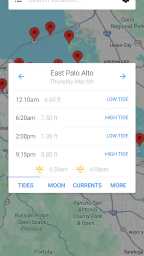
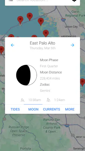
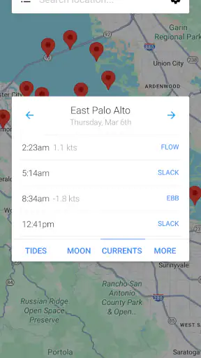
Planning around the sea is different from checking a normal daily forecast. A general weather app may tell me whether rain is likely, but it does not answer the practical question I often need first: when will the water be high or low at a particular coastal location? My Tide Times is built around that narrower problem, and in my experience its value comes from keeping tide information at the centre instead of burying it among unrelated weather cards.
This is a free weather app from JRustonApps B.V., aimed at anyone who needs tide tables and forecasts on a phone. It is suitable for Everyone, runs on Android from version 8.0 onward, and has reached over one million installs. Its average score is 4.8 from around twenty-seven thousand ratings, with roughly one thousand three hundred written reviews. Those figures suggest that it has found a clear audience, although popularity alone is not a reason to trust a tide prediction blindly.
I would describe it as a focused planning tool rather than a complete marine navigation system. That distinction matters. It can help me decide when to walk along a beach, arrange a fishing trip, choose a better time for photography, or avoid arriving at a harbour when the water level is inconvenient. It is less suitable as my only source for decisions where changing conditions, local warnings, or professional navigation information are critical.
How the tide-focused design feels in everyday use
A clearer answer than a general weather forecast
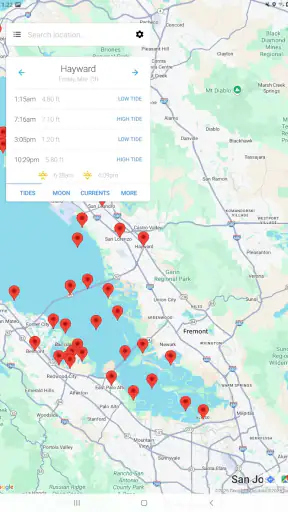
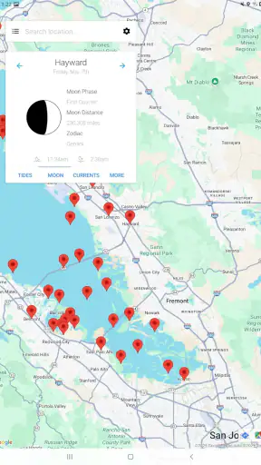
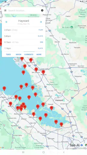
The strongest part of the experience is the app’s subject matter. Instead of making me search through a broad forecast to find coastal information, it presents the day around tide changes and expected water movement. For a casual user, that focus reduces the mental work involved in turning a forecast into a plan.
I find this especially useful when the tide is the deciding factor rather than the weather. A beach can look completely different at low water, while a narrow shoreline may be difficult or unpleasant to explore at high water. A normal weather app might show sunshine and a comfortable temperature, yet still leave me with the wrong impression about whether a coastal outing will work.
The app also makes more sense when I think in terms of a routine. I can check a location before leaving home, compare the expected tide times with my available hours, and make a simple decision. That is more practical than opening several websites, dealing with different layouts, and trying to work out whether each source refers to the same coastal point.
Useful for more than boating
Boaters and anglers are obvious users, but they are not the only people who can benefit. I would also consider it for photographers looking for exposed rocks, families visiting tidal pools, walkers following coastal paths, and travellers staying near a harbour. Even a person planning a short dog walk may want to know whether a familiar stretch of sand will be accessible.
One realistic example is a weekend visit to a rocky beach. If I arrive during a rising tide, a route that was comfortable earlier may become cramped or cut off. I can use the tide table to choose a safer window, then check the ordinary weather forecast separately for wind and rain. That division of labour is important: the tide app helps with water timing, while a broader forecast remains better for the rest of the atmosphere.
Another useful situation is fishing from shore. The app can help me organise the timing of the trip instead of treating the tide as an afterthought. I would still account for local knowledge, wind direction, swell, access restrictions, and safety conditions, but having the tide schedule in one focused place makes the first stage of planning quicker.
What I would check before relying on a location
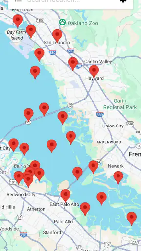
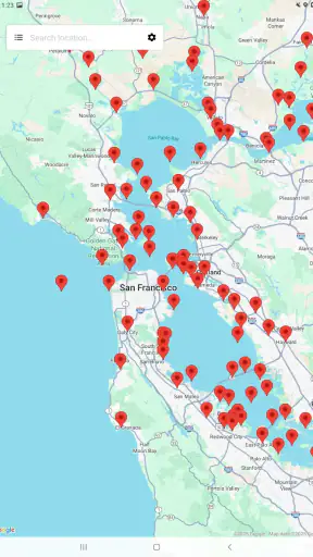
The location is more important than the attractive simplicity of the interface. Tide predictions are tied to particular coastal points, and two places that look close on a map may not behave identically. I would therefore take a moment to confirm that the selected station actually represents the beach, pier, inlet, or harbour I intend to visit.
That is one of the less obvious habits that improves the experience: do not choose a location merely because its name sounds familiar. When planning a trip, I would compare the selected place with a map or a local harbour reference, especially if the coastline is complicated. A clean table can still lead to a poor decision if the wrong station is being viewed.
I would also treat the times as planning guidance, not as a promise that the water will behave exactly as shown at every point along the shore. Weather and local conditions can affect what I actually see. The app is most useful when I combine its schedule with common sense rather than letting a precise-looking time create false confidence.
Reading the information as a plan, not just a list
A tide table is easy to glance at and easy to misuse. I prefer to look at the whole sequence for the day instead of focusing on one high or low point. The interval between changes can be more relevant than the event itself. For example, a low tide at a convenient hour may not leave enough time for a long walk before the water begins returning.
My practical workflow is to identify the activity first, estimate how long it will take, and then use the table to test whether the timing is realistic. For a short beach visit, I may only need a broad window. For a longer coastal walk, I would leave extra margin and consider escape routes. This makes the app more valuable than simply checking whether the next tide is labelled high or low.
That approach also exposes a limitation. The app can organise tide information, but it cannot decide whether a route is safe for a particular person, whether a beach is crowded, or whether a path has been closed. It supports judgement; it does not replace it.
Trust, controls, and data-sensitive moments
When I review a utility app, I pay attention not only to what it displays but also to how comfortable I feel using it. The public details identify JRustonApps B.V. as the developer, and the app is presented as a free weather product with an Everyone age rating. That gives it a straightforward profile for general users, including households where a child may open the app, although an age rating should never be confused with a guarantee about every aspect of data handling.
I would look closely at the choices presented during setup and normal use. If the app asks for a location, I would consider whether it needs my precise position or whether I can select a coastal station manually. For a tide table, manual selection can be a sensible privacy-conscious habit because I may not need continuous location access just to check a harbour before a trip.
This is a useful distinction between convenience and control. Automatic location selection may save time when I am travelling, but manually choosing a station gives me a clearer understanding of what the app is using. I would grant only the access that matches the task, review the operating system’s permission controls, and remove access later if I no longer need it.
I would apply the same caution to notifications or background behaviour if those choices appear on my device. A tide reminder might be helpful for a regular fishing routine, but it is not essential for everyone. If I only check the app occasionally, I would avoid enabling extra alerts simply because they are offered. The best setup is the one that gives me the information I need without turning a small tide table into a constant source of interruptions.
Where it compares well with usual alternatives
The usual alternative is a broad weather app. That option wins when I need wind, rain, temperature, radar, and tide information together, especially before a full day outdoors. However, broad apps often make coastal timing feel secondary. I prefer this app when the tide is the first question I want answered and I do not want to scroll past unrelated forecast panels.
Another alternative is a website opened in a mobile browser. A website may be better when I need official local notices, harbour information, safety warnings, or a wider collection of marine details. It can also be preferable on a shared computer before a group trip. The phone app becomes more convenient when I want a quick repeatable check without rebuilding the same search each time.
For serious navigation, I would choose a dedicated marine solution or official local source instead. Tide timing is only one part of safe passage. Charts, hazards, weather warnings, currents, vessel information, and local regulations can matter just as much. I would not use this app as a substitute for equipment or information designed for professional or high-risk decisions.
Small habits that make the app more dependable
My first recommendation is to check the location before checking the time. This sounds obvious, but it is the easiest way to prevent a polished table from answering the wrong question. If I am visiting an unfamiliar coast, I would verify the station name against the actual destination and keep the local geography in mind.
Second, I would check the table again shortly before leaving if the plan depends on a narrow window. I would not rely on a screenshot saved days earlier for a trip where access changes quickly. A fresh look also gives me a chance to notice whether I selected a different date or location during an earlier search.
Third, I would build in a buffer. If a route becomes unsafe soon after high water, I would not schedule my return for the exact predicted turning point. The most useful tide app habit is not chasing perfect precision; it is using the information to avoid obviously poor timing while leaving room for real-world variation.
Finally, I would pair the app with a separate weather check. A favourable tide does not make strong wind, heavy rain, poor visibility, or rough surf harmless. This two-step workflow is more reliable than expecting one specialised app to cover every coastal risk.
Who should use it, and who should skip it?
I think it is a good fit for people who regularly visit beaches, piers, estuaries, and harbours and want a dedicated way to check tidal timing. It is also a sensible choice for occasional travellers who find general weather apps too cluttered when all they need is a coastal schedule. The free price makes it easy to try without committing money, and the Everyone rating keeps it approachable for a broad audience.
I would be more cautious about recommending it to someone who expects a full marine command centre. If the main need is navigation, detailed chart work, live hazard information, or comprehensive weather analysis, a dedicated marine tool is likely the better choice. Likewise, a person who never visits the coast will gain little from installing a specialised tide application.
The app may also be less convenient for someone who wants every outdoor condition in one screen. In that case, a strong general weather service may reduce switching between apps. I personally see that as a trade-off rather than a flaw: the narrower focus makes tide checks easier, but it means I still need another source for the rest of the trip.
Version, longevity, and the final decision
The current version is 26.3.1, and the app has been available since January 22, 2014. That long presence gives me more confidence in its role as an established utility than I would have with a newly released tide tool, though it still does not remove the need to check current conditions and local information.
My final view is cautiously positive. The real strength is focused decision-making: when I need to know whether the tide fits a coastal plan, this app is more direct than a general forecast. I like it for beach walks, shoreline photography, casual fishing, and holiday planning, provided I select the right station and leave a sensible safety margin.
I would not treat it as an authority for high-risk navigation, and I would not assume that a tide prediction tells me everything important about the sea. Used within those boundaries, it is a practical free companion with a clear purpose. If your coastal plans regularly depend on high and low water, I think it is worth trying; if you need a complete marine information system, look beyond it and use this kind of tide table only as one part of a broader check.


